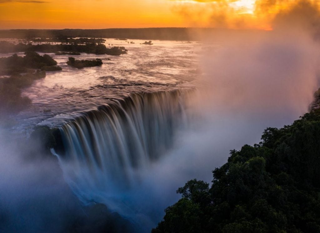
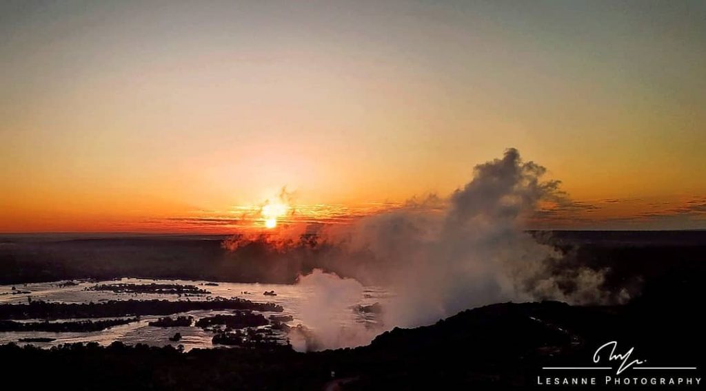
As I write this (late April 2020), the Victoria Falls is tracking for an all-time high peak water flow, and I can hear the rumble of The Falls from my cottage in Victoria Falls town. The distinctive roar of the largest waterfall on Earth, a constant reminder of the immeasurable power of nature.
Victoria Falls is NOT Dry
The Victoria Falls is certainly not dry (as you might have heard). Quite the opposite in fact. Towards the end of 2019, a few photos/videos were circulated in the mainstream media showing portions of Victoria Falls in its seasonal low water flow and implying that the Falls had been “reduced to a trickle”.
It seems the force of nature that is the Zambezi River got wind of this fallacy, and although she doesn’t have any international visitors due to global lockdowns, she’s showing us locals what she’s got.
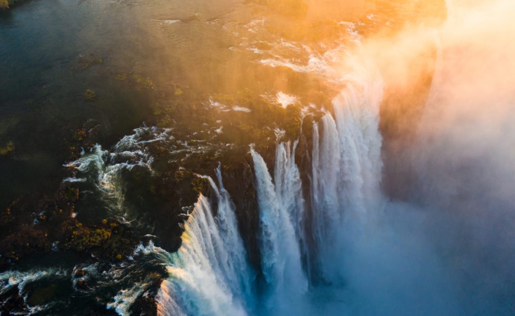
As the water levels of the Victoria Falls are influenced by the flow levels of this mighty river, the volume of water flowing over The Falls is exceptional, and the spray cloud (from which the Falls derive their local name, “Mosi-oa-Tunya” – The Smoke That Thunders) can be seen for miles around.
Fast Facts about the Victoria Falls
Seasonal Variations of Victoria Falls
- The Victoria Falls are fed by the Zambezi River, which flows down from its source in Northern Zambia. Every year the level of water flowing in the Zambezi rises and drops seasonally, and these natural fluctuations are a result of seasonal rainfall within the catchment area of the river.
- The water levels are at their lowest toward the end of the dry season (after many months of no rain), and then start to rise slowly once the rains start.
- Typically, low water season runs from (late) August to (mid) December, water levels rise through January and February (mid-water) to High Water levels experienced in March/April/May, and then drop again in June / July. The levels vary depending on timing and volume of rainfall during the year, and so these seasonal dates are just guidelines.
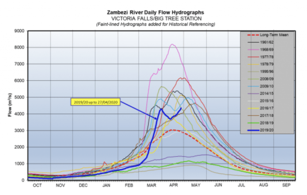
Tracking for a High Water Year
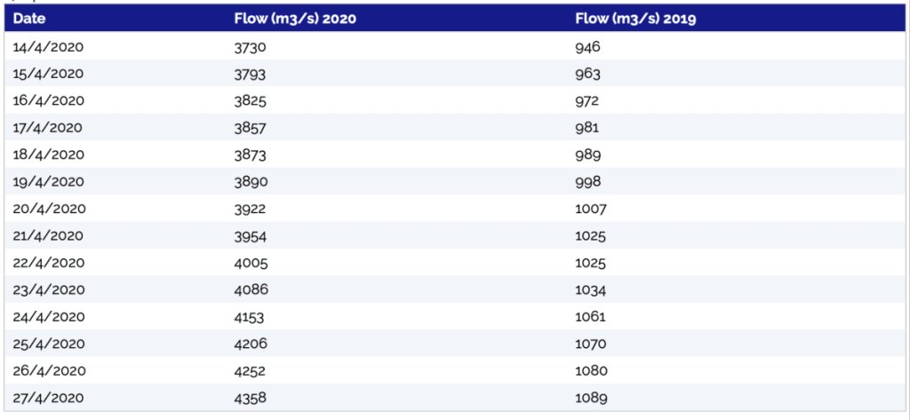
The river flow recorded by the Zambezi River Authority gives a quantitative comparison of the water levels. The flow (m3/s) for the last two weeks of April in 2020 compared to the same period last year shows that the flow this year is about four times higher than last year.
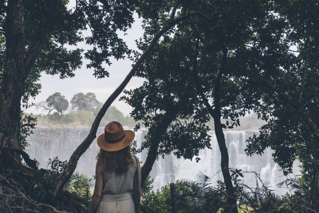
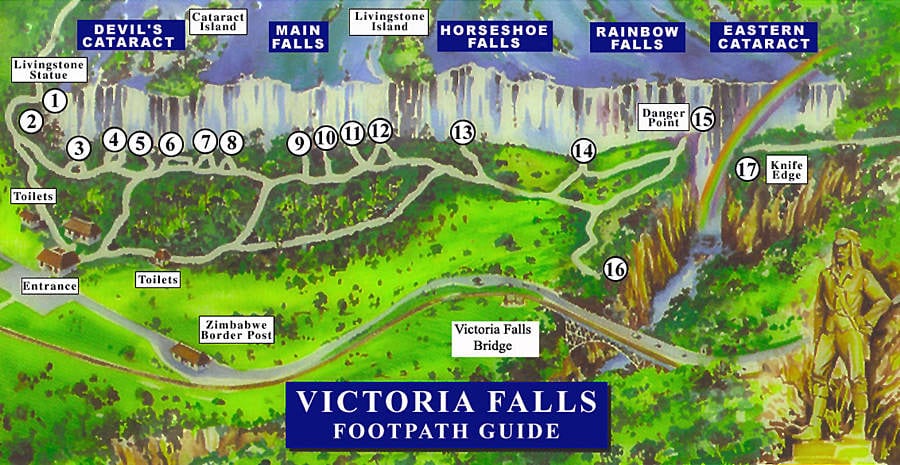
Viewing and Visiting the Victoria Falls
- The Zimbabwean side of the falls lies lower than the Zambian side, so there is always more water flowing over the Zimbabwean side.
- In low water season, the Falls is best viewed from the Zimbabwean side.
- There are benefits to visiting in each of the different seasons (for example, the Devil’s Pool experience is only accessible in low water, and white water rafting operates only in low-(to mid-)water season).
- With a width of 1.7 km, of course the Falls cannot be captured in a single image or video from land – aerial shots give the best view of the full length of the falls, and videos from different viewpoints along the walking tour of the Falls show the true reality.
Looking for more information about the Victoria Falls?
If you’d like to learn more about the Victoria Falls and the surrounding area, we highly recommend the “Guide to Victoria Falls” put together by Victoria Falls residents, Tony and Boo Peel of Victoria Falls Guide.
If you’d like more insights on river flow levels, the Zambezi River Authority are the experts in this regard. Historic raw data is available on request – and this plots as per the hydrograph above.
If you’re looking for more insights into what the low water season looks like:
This Youtube Video made by a friend of Matetsi Victoria Falls on Sunday 15 December 2019 shows an unbiased view of the falls from the Zambian side and the Zimbabwean side.
And this article by the African Travel and Tourism Association explains more about the water levels of the Victoria Falls.
Social media accounts that are sharing beautiful Victoria Falls content:
Matetsi Victoria Falls Facebook / Instagram
Shaun McMinn African Eye / Facebook / Instagram
Lesanne Photography Facebook / Instagram
Tom Varley Photography Facebook / Instagram